The sun was shining, Glenn was very well rested and
we both had new attitudes after yesterday's difficult start!
Glenn left Globe at 7:30 AM and was thrilled that his
route was a straight shot across Rte. 70 for 72 miles.
No turns, no GPS required today!
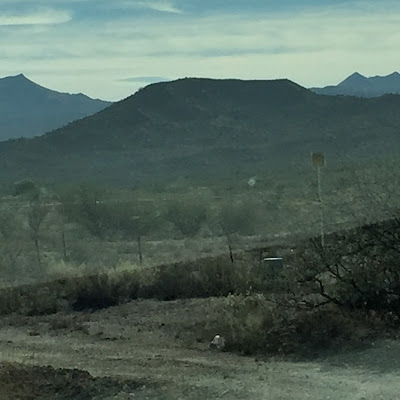
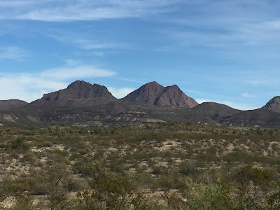
My drive was also very easy so I
could really concentrate on the
spectacular scenery
A small airport in the middle of nowhere!
Local people refer to the entire mountain range southwest of Safford as Mt. Graham. The actual name "Pinaleño Mountains" comes from an Indian word meaning "many deer", or "deer mountain." The summit of the Pinaleño Mountains, Mount Graham(also known as High Peak), is at an elevation of 10,720 feet.
Found Glenn along Rte. 70 about 42 miles into today's journey.
All smiles and no complaints! The temps made it to the
low 80's today which sure beats the 90's yesterday!
You know how much I love to find bike related signs on our rides.
Well, not one thing today. No bike lane signs or share the road signs.
You'll see below, the most interesting signs I could find on this route!
This entertained Glenn as he took a break!
Considering how many times we have seen cotton
fields in the southeast, this is the first time he has
seen how it is picked by machine instead of man.
I was hoping to see some animals....I'm on
a Southwest safari....all I saw were cows and horses
behind fences. Maybe tomorrow!
We were amazed to see many cotton fields as
we entered the Safford area!
Agriculture is considered to be a main economic product with cotton
fields and a gin located in the city. A billboard along US Highway 70
announces "Safford .... Copper, Cattle & Cotton".
No tumbleweed yet, but cotton balls blow across the road!
We never tire of this kind of scenery!
While living I want to live well.....Geronimo
I was born on the prairies where the wind blew free and there was
nothing to break the light of the sun.
I was born where there were no enclosures....Geronimo
Didn't see any stagecoaches or tracks but
it is easy to envision early life here. We thought
that we could find some historical info about this
road but none came up. It does run through an
Apache Reservation and is lined with farms
with views of volcanic mountains.
Back to the Future!
This phone looks like my dad's first car phone -
big, bulky, and difficult to stick in one's pocket or purse!
Knowing that we would be in some rather desolate areas,
we thought that renting satellite phones would be wise so
that we can also communicate on the road. Thankfully, we
have not had to use them yet. Tomorrow may be challenging!
Today's Stats!
Glenn rolled into Safford, AZ around 1 PM.
He pedaled 73.41 miles in 4:36 hours!
The ascent was 1819 feet...rolling hills but no
mountains to climb today!
In case you wonder how he replenishes these calories
during the ride....he eats 2-3 peanut butter and nutella/honey
sandwiches, a piece of fruit, homemade trail mix and
his camelback and two water bottles are filled to the brim
each morning. Today he couldn't resist stopping for
a root beer float in Pima, AZ because the 20 or more
signs along Rte. 70 for Taylor's Tastee Freeze lured him in!
Help us answer this question and win a logo decal like this one above!
As we wander the roads here in the Southwest, the scenery
reminds us of this print that hangs in our office at home
(minus the water). At one time, we knew the name of the
artist but those brain cells are gone and we have given up
trying to recall it. Decals to anyone who can help us!


Glad today was better then yesterday !!!! Scenery is pretty! While Glenn is pedaling there must be some beautiful turquoise jewelry stores along your route������!!!
ReplyDeleteNo jewelry stores in sight! Maybe today!
ReplyDeleteSo far so good! Happy November ! XOXO
ReplyDeleteNew Day....New Month.....New State! Oh maybe that should be tonight's blog title!
ReplyDeleteLove cotton. Looks like a great ride
ReplyDelete